Muggaccinos.com The Bullsheet Sunrise 6:44am BOM weather 4'cast
|
Sunday,
21May
'23 -
Hornsby
station carpark 7:45am, or
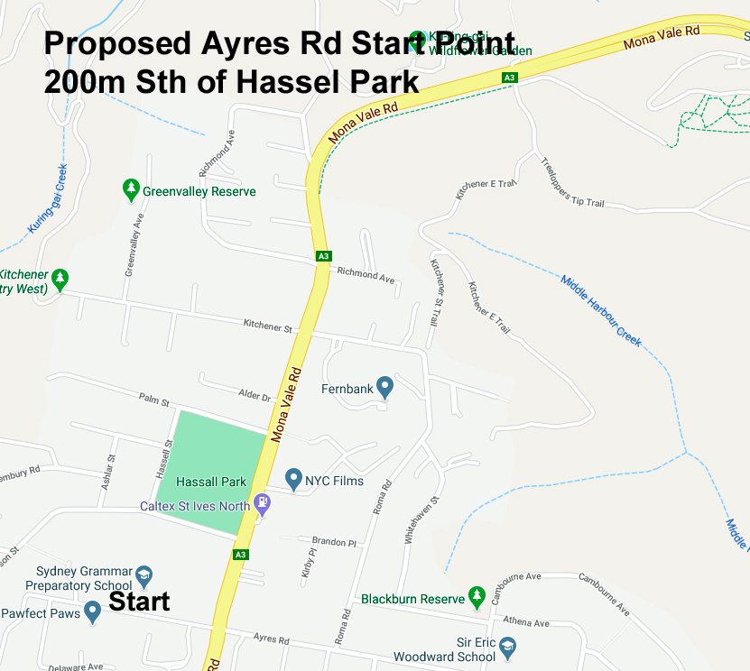
Ayres
Rd/Mona Vale Rd, East St Ives 8:05am,
or
outside
Terrey
Hills Fruit Barn 8:20am
or
outside
Tempo Cafe,
Terrey Hills 8:30am to catch 10.30am
Ferry from Palm Beach
Wharf to
Wagstaffe Wharf
(ferry timetable).
Thence cycle via Killcare, McMasters
Beach,
Marie Byles Lookout,
Cullens Rd to
Woy Woy
Fishermans' Wharf for early lunch, then 300m to
Woy Woy station train back to Hornsby
- max route 77km, slightly/flatter shorter from Turramurra station to St Ives
then
Tempo Cafe,
Terrey Hills start from 8:30am. |
||||||||||||||||||||||||||||||||||||||||||||||||||||||||||||||||||||||||||||||||||||||||||||||||||||||||||||||||||||||||||||||||||||||||||||||||||||||||||||||||||||||||||||||||||||||||||||||||||||||||||||||||||||||||||||||||||||||||||||||||||||||||||||||||||||||||||||||||||||||||||||||||||||||||||||||||||||||||||||||||||||||||||||||||||||||||||||||||||||||||||||||||||||||||||||||||||||||||||||||||
|
Print out 77.2km Ride Description and 77.2km Summary Data |
||||||||||||||||||||||||||||||||||||||||||||||||||||||||||||||||||||||||||||||||||||||||||||||||||||||||||||||||||||||||||||||||||||||||||||||||||||||||||||||||||||||||||||||||||||||||||||||||||||||||||||||||||||||||||||||||||||||||||||||||||||||||||||||||||||||||||||||||||||||||||||||||||||||||||||||||||||||||||||||||||||||||||||||||||||||||||||||||||||||||||||||||||||||||||||||||||||||||||||||||
|
WHO, WHEN,
WHERE: Descend to Church Point for 1st Sag Stop (5 min) from 9:15am. The cycle to Palm Beach Ferry.
Chris aka RecalcitrantBankTeller
plans to cycle to
Woy Woy
Fishermans' Wharf. Jean aka ChiliDog [4th Acceptor] may catch the ferry to Manly and ride to Palm Beach. George aka Englishman [5th Acceptor] is a starter.
APOLOGIES: Eric aka PapaBear is recovering from a hip replacement last Wed. If you are >80% of joining us, contingent upon a fine morn', please e-mail or 'phone Scribe and he will add ya in the above. |
||||||||||||||||||||||||||||||||||||||||||||||||||||||||||||||||||||||||||||||||||||||||||||||||||||||||||||||||||||||||||||||||||||||||||||||||||||||||||||||||||||||||||||||||||||||||||||||||||||||||||||||||||||||||||||||||||||||||||||||||||||||||||||||||||||||||||||||||||||||||||||||||||||||||||||||||||||||||||||||||||||||||||||||||||||||||||||||||||||||||||||||||||||||||||||||||||||||||||||||||
|
Snapshot: From outside Tempo Cafe, Terrey Hills 8:30am left and descend McCarrs Creek Rd for 1st Sag Stop at Church Point (5 min) from 9:15am. By 9:25am thence 4km later L into Mona St, R into Waterview St, L into Barrenjoey Rd near Bungan Beach, thru Newport, Bilgola, left into Old Barrenjoey Rd passing thru Avalon Village. Left returning onto Barrenjoey Rd for 6km to arrive Palm Beach Wharf by 10:20am to catch 10:30am ferry ride and take 1st Nosh Stop (30 min trip) to Wagstaffe Wharf. Upon alighting the ferry, we pedal 7km Nth from Wagstaffe Wharf to Marie Byles Lookout, McMasters Beach, continue Nth 9.4km to Cnr Scenic Rd & Cullens Rd. Then 15.4km from Cullens Rd to Woy Woy Fishermans' Wharf.
SagStops: 2nd Marie Byles Lookout, McMasters Beach
|
||||||||||||||||||||||||||||||||||||||||||||||||||||||||||||||||||||||||||||||||||||||||||||||||||||||||||||||||||||||||||||||||||||||||||||||||||||||||||||||||||||||||||||||||||||||||||||||||||||||||||||||||||||||||||||||||||||||||||||||||||||||||||||||||||||||||||||||||||||||||||||||||||||||||||||||||||||||||||||||||||||||||||||||||||||||||||||||||||||||||||||||||||||||||||||||||||||||||||||||||
|
1st Leg: Hornsby Jersey St carpark to Tempo Cafe, Terrey Hills 13.9km 40 min depart Hornsby 7:45am - arrive Tempo Cafe, Terrey Hills 8:30am 2nd Leg: Tempo Cafe, Terrey Hills to Church Point 16.2km 45 min depart Tempo Cafe, Terrey Hills 8:30am - arrive Church Point 9:15am 3rd Leg: Church Point to Palm Beach General Store 18.6km 55 min depart Church Point 9:20am - arrive Palm Beach Wharf by 10:20am for 10:30am ferry 4th Leg: Wagstaffe Wharf to Marie Byles Lookout 7.0km 21 min depart Wagstaffe Wharf 11am - arrive Marie Byles Lookout 11:08am 5th Leg: Marie Byles Lookout to Cnr Scenic Rd & Cullens Rd 9.4km 30 min depart Marie Byles Lookout 11:30am - arrive Cnr Scenic Rd & Cullens Rd 11:54am
6th Leg:
Cullens Rd to
Woy Woy
Fishermans' Wharf 15.4km 45 min
depart
Cullens Rd 12pm - arrive
Woy Woy Fishermans' Wharf
12:41pm |
||||||||||||||||||||||||||||||||||||||||||||||||||||||||||||||||||||||||||||||||||||||||||||||||||||||||||||||||||||||||||||||||||||||||||||||||||||||||||||||||||||||||||||||||||||||||||||||||||||||||||||||||||||||||||||||||||||||||||||||||||||||||||||||||||||||||||||||||||||||||||||||||||||||||||||||||||||||||||||||||||||||||||||||||||||||||||||||||||||||||||||||||||||||||||||||||||||||||||||||||
|
Risk
Warning A negligent cyclist could - (a) be litigated by a seriously injured cyclist, or 3rd party (ie. a woman pushing a pram on a footpath or a car driver) under common law where the damages could exceed $500,000; and (b) lose his/her home if he/she did not have public liability insurance which covers their negligence whilst on a push bike. A negligent cyclist who did not have personal injury insurance (ie self-employed without income protection cover) could struggle to meet regular outgo commitments.
A seriously injured cyclist could be awarded damages
which a negligent cyclist could not afford to pay if the negligent
cyclist -
Ø
Cycling without Public Liability cover is as silly
as driving without 3rd Party -
Ø Click on: Risk Management which warns of 'inter alia', the dangers of cycling on public roads with motor cars, potholes and over bridges with vertical timber planks with gaps Ø Cycling with Muggs is predicated upon notifying Bank Teller if you materially disagree with any clause(s) in Muggaccinos' "Ride Participants Liability Acknowledgment" |
||||||||||||||||||||||||||||||||||||||||||||||||||||||||||||||||||||||||||||||||||||||||||||||||||||||||||||||||||||||||||||||||||||||||||||||||||||||||||||||||||||||||||||||||||||||||||||||||||||||||||||||||||||||||||||||||||||||||||||||||||||||||||||||||||||||||||||||||||||||||||||||||||||||||||||||||||||||||||||||||||||||||||||||||||||||||||||||||||||||||||||||||||||||||||||||||||||||||||||||||
|
16 April 23 - Sunday's Hornsby, Beaumont Rd, Cowan General Store & Cafe. Return via Kalkari Reserve to Hornsby - 43km - 3 riders
Click on 'Relive' image to view last Sunday's ride. Then click on the 'Right Arrow' therein. Then click on: View interactive route > to evidence a further application of Google Earth 9 April 23 - Galston Gorge - Berowra Waters C/W loop
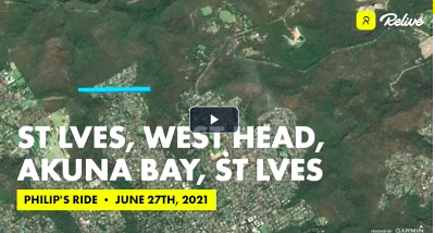
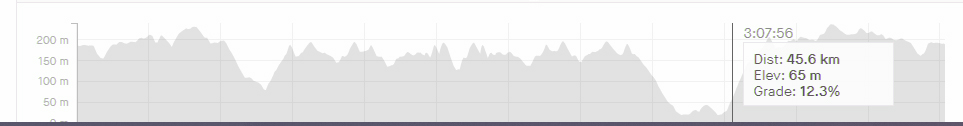
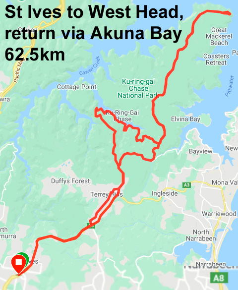
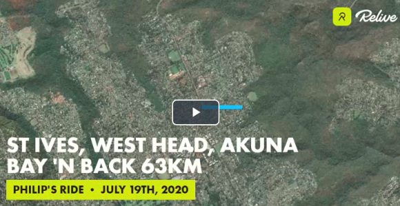
Sunday's East St Ives, West Head, Akuna Bay, Illawong Bay thence up the hill back to St Ives - 60km
Click on the above 'Relive' image to view last Sunday's Visit to glorious, but steepish West Head, returning via Akuna Bay and Illawong Bay, thence back to N/E St Ives - 60km in Google Earth.
Then click on the 'Right Arrow' therein.
Then click on:
View interactive route >
to evidence a further application of Google Earth
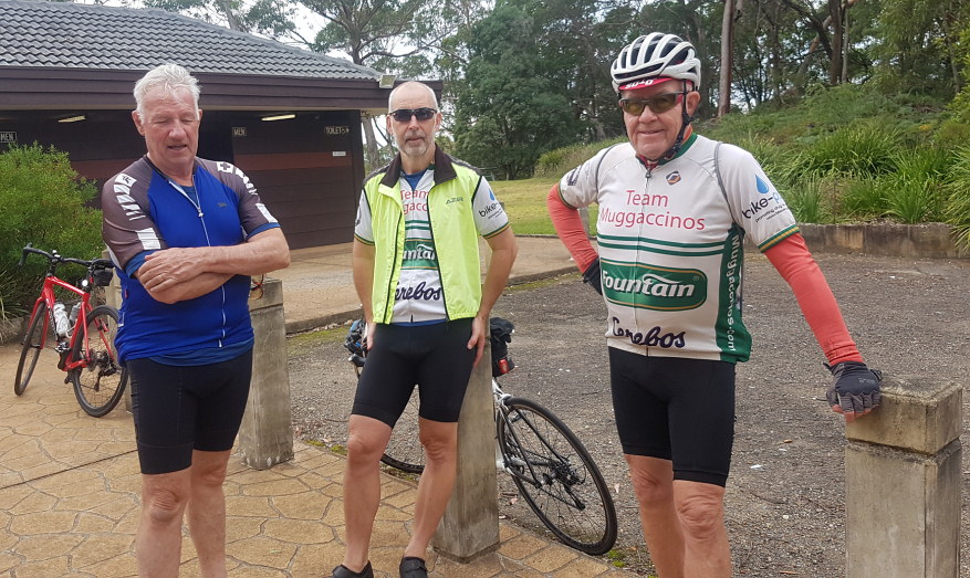
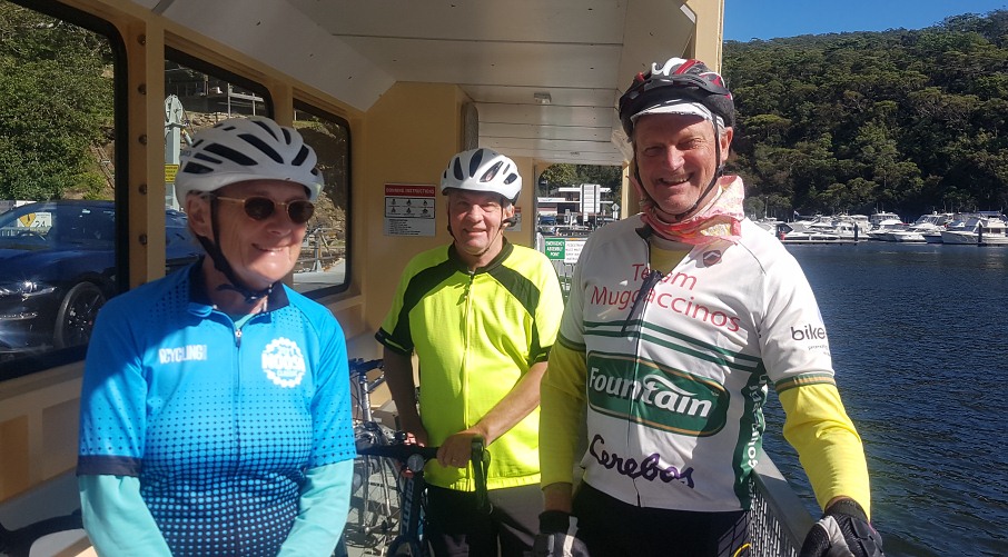
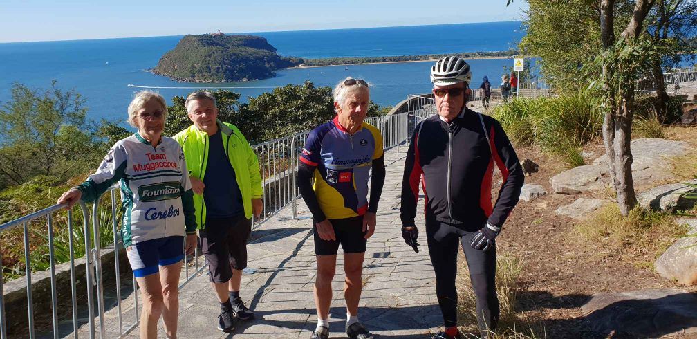
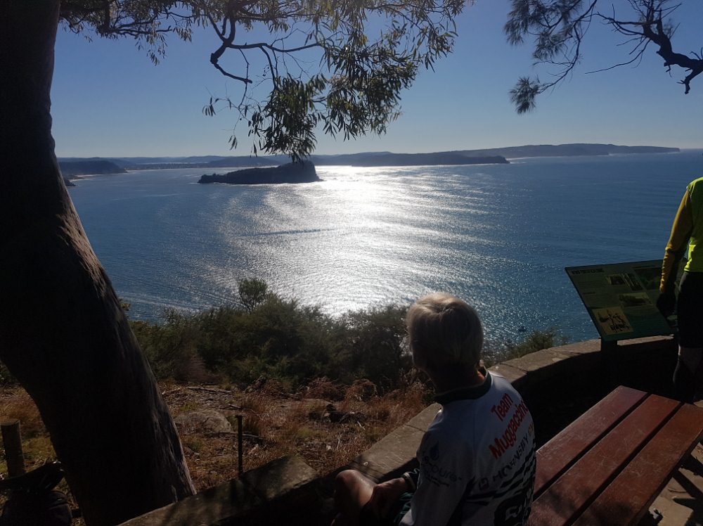
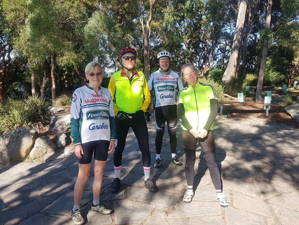
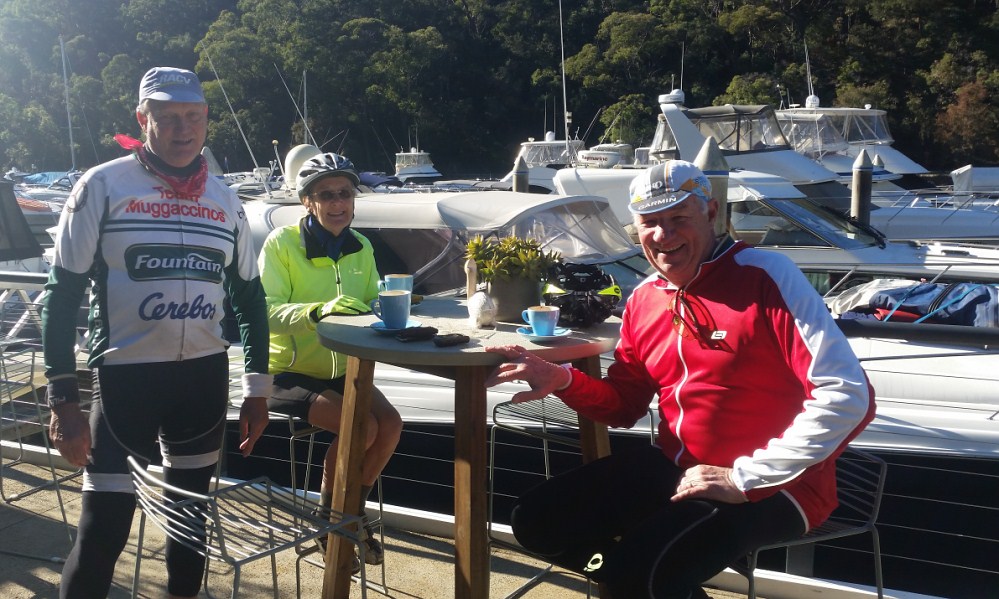
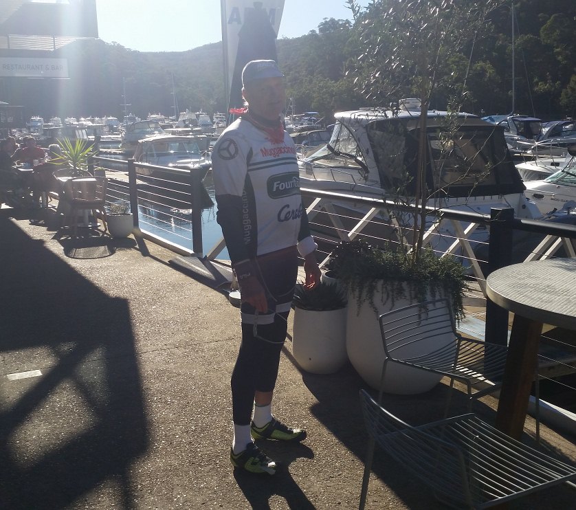
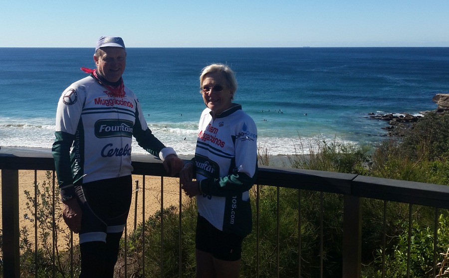
Below are ToothFairy's four pics on a sunny Winter's morn'.
St Ives, West Head, return via Illawong Bay - 62.5km - 7 riders if we count in Michael aka GoodMorningVietnam and George and Chris who joined our ride at Akuna Bay
Click on above 'Relive' image on RHS to view last Sunday's St Ives, West Head, return via Akuna Bay - 62.5km in Google Earth.
Then click on the 'Right Arrow' therein.
Then click on:
View interactive route >
to evidence a further application of Google earth
St Ives, Illawong Bay, Akuna Bay, Warriewood, Wakehurst Pky - 65km
Akuna Bay Nosh Stop of a corker of a Winter's morn', albeit a tad 'fresh' early
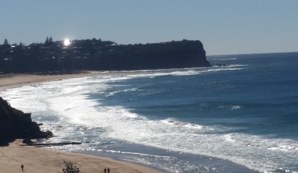
View from the Warriewood Headland
Hornsby to Wyong - 93km - 9 riders
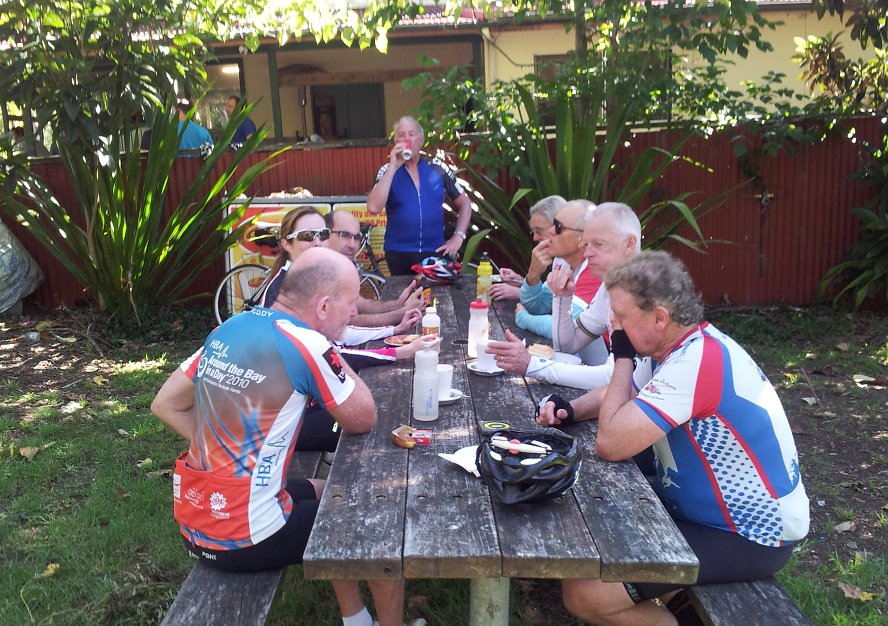
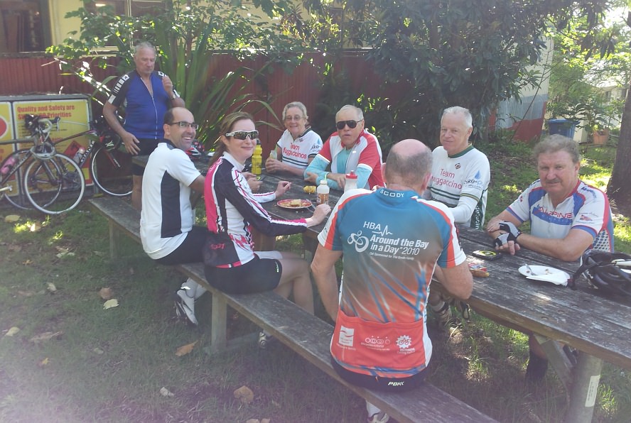
Above three Happy Snaps at Mt White Village store après 35km
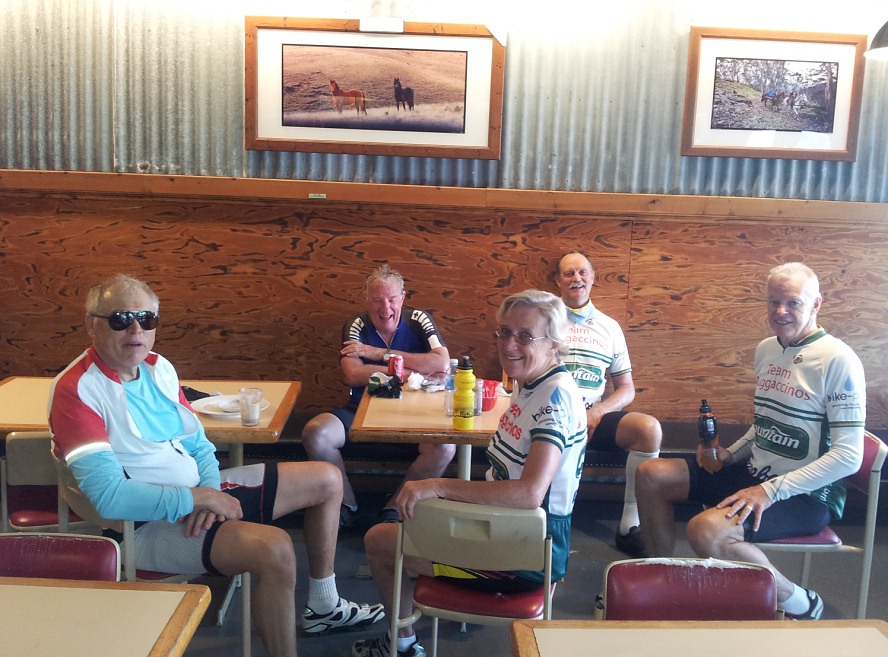
The cafe in the gas station at Yarramalong Valley after 75km |
||||||||||||||||||||||||||||||||||||||||||||||||||||||||||||||||||||||||||||||||||||||||||||||||||||||||||||||||||||||||||||||||||||||||||||||||||||||||||||||||||||||||||||||||||||||||||||||||||||||||||||||||||||||||||||||||||||||||||||||||||||||||||||||||||||||||||||||||||||||||||||||||||||||||||||||||||||||||||||||||||||||||||||||||||||||||||||||||||||||||||||||||||||||||||||||||||||||||||||||||
| Scribe 8 Jan '17 |


.jpg)
.jpg)
.jpg)


