Muggaccinos.com The Bullsheet
Sunday, 2 Sept '07 - SOUTHERN START OPTION Tour de Richmond, Hawkesbury Heights, Springwood, Mitchell Pass - ETR Turramurra station 3:15pm
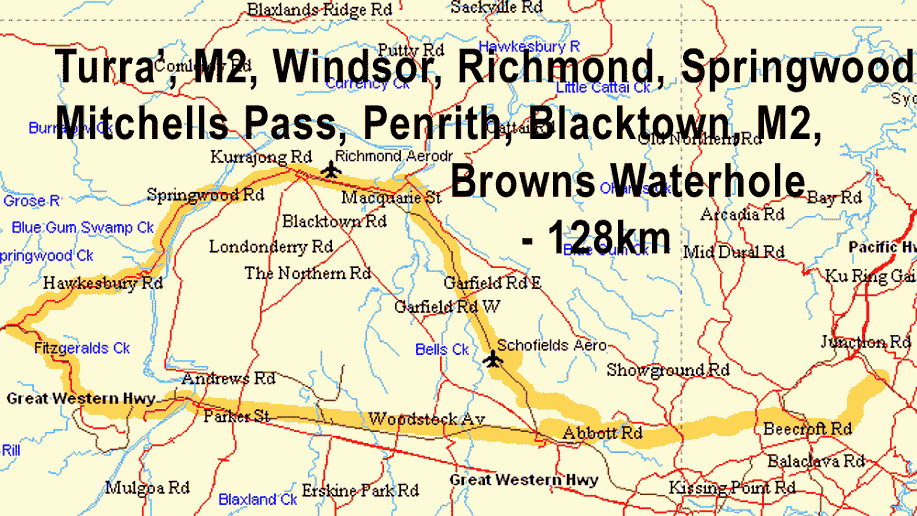
* Scribe will be at Turramurra station carpark 7:45am for 124km route via Browns Water Hole, (8:05am from Vimiera Rd, Marsfield), Epping Rd, Pembroke St, M2 to Marayong and follow rail line to Windsor and stay on main drag to Richmond Oval where we plan to meet cyclists for 1st Nosh Stop (35 min) from 10:25am who commenced from Hornsby or Dural who are cycling to Richmond ' back
* Or Turramurra station carpark 8:30am for 91km route via M2 to Seven Hills station to aboard 9:50am train arriving Richmond at 10:28am (reducing 1st Leg to Richmond by 32km) (Let Scribe know if you want to ride this abridged route, otherwise you might be the only cyclist in Turra' carpark then)
Thence
from 11am up Yarramundi
to Springwood to 2nd Nosh Stop at Springwood, thence descend
Mitchells Pass
to -
* Emu Plains train to Blacktown
station; or
* Penrith train to Seven Hills
Thence
M2, Browns Water Hole,
Kissing Point Rd -
ETR Turramurra 3:15pm
NB: Route increases by 40km to 164km if you cycle M4 rather than catch
train from Emu Plains or Penrith
Ø If driving from Inner West, park at most Northerly Point in Vimiera Rd Marsfield to join ride
Ø Ride Organiser: Phil Johnston 9114.6689 or 0412 045.224
Ø Hardcopy these directions and bring on Sunday
Ø Expend 10 min studying the street map to familiarize with the below 2nd 'n 3rd Ride Legs
Ø Bring a hardcopy of this and Ride Description at 124km or 91km in 'Ride Calendar 2007 - July to Sept'
Ø
Cycling
without Public Liability cover is as silly as driving without 3rd Party -
join Bicycle NSW for PL insurance, so that all Muggs are better protected
Ø Click on: Risk Warnings which warns of 'inter alia', the dangers of cycling on public roads with motor cars, potholes and over bridges with vertical timber planks with gaps
Ø Cycling with Muggs is predicated upon notifying Bank Teller if you materially disagree with any clause(s) in Muggaccinos' "Ride Participants Liability Acknowledgment"
|
Snapshot:
Long Route:
Start 7:45am from
Turramurra station
carpark and cycle to Richmond
via
Browns Water Hole, (8:05am
from Vimiera Rd, Marsfield), Epping Rd, Pembroke St, M2
onto Marayong, Riverstone, Vineyard by following rail line to Windsor,
then
main drag to Richmond.
KOM Climbs: |
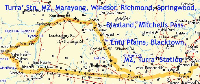
a)
Longer Route cycling from Turramurra station Rohini St car park via M2 to Marayong, Riverstone, Vineyard following rail line to Windsor and along the main drag to Richmond – 55.4km|
Rollout 7:45am: |
|
* R Sth 200m up Rohini St
to traffic lights on Pacific H'way |
|
at roundabout onto Hambledon Rd. 750m later L into Bali Drive (through housing estate) R at "T" junction into Walker St and 600m L into Burdekin Rd and follow this for 600m when it becomes Railway Terrace. Follow railway line to Schofields and continue to Riverstone along Railway Tce. |
|
Where Riverstone station level crossing is on your LHS, turn R then immediately L and follow the railway line on your LHS. Riverstone Parade take us to Vineyard Station. At Vineyard station road veers to the R. Turn L into Wallace Rd after 50m. |
|
Follow railway line along where Wallace Rd ends at a "T" intersection. Turn L and cycle over a level railway crossing, and turn R into Railway Rd and remain on it for about 1k to Mulgrave Station where we R onto Mulgrave Rd and follow until you reach Windsor Rd. Turn L into Windsor Rd, and follow it 3km to Windsor. Continue on main drag of Windsor/Richmond Rd for 5km for 1st Nosh Stop (35 min) from approx 10:25am at The Blue Lagoon Cafe opposite Richmond Oval where U meet cyclists (for 1st Nosh Stop) who started from Hornsby station who are riding back. |
Start
Shorter
Route
catching train from Seven Hills station:
Turramurra
station
Rohini St
car park
via above explained new access onto M2 to Seven Hills station, thence train to
Richmond station – 22.4km:
Rollout 8:30am and follow above directions in yellow background to end of M2/Abbott Rd which is at traffic lights with Johnson Ave.
D Continue ahead 700m along Prospect Highway to Seven Hills station on LHS, enter via Terminus Rd. Quickly buy a snack and catch 9:50am train for 38 min journey to Richmond arriving 10:28am and exit Richmond station to meet cyclists who cycled all the way to Richmond and pigged-out at Blue Lagoon Fish Shop, Richmond opposite Richmond Oval .
2nd Leg: Richmond, Yarramundi, Springwood - 26km
11am:
|
Market St |
0.1 |
~ |
NWW |
March St |
22.4 |
|
March St |
0.6 |
~ |
SSW |
Bosworth St |
23.0 |
|
Bosworth St |
0.3 |
~ |
SWW |
Castlereagh Rd |
23.3 |
|
Castlereagh Rd |
4.0 |
~ |
SWW |
Springwood Rd |
27.3 |
|
Springwood Rd |
11.4 |
/ |
SWW |
Hawkesbury Heights Lookout |
38.7 |
|
Hawkesbury Road |
9.1 |
~ |
SWW |
Macquarie Rd |
47.8 |
|
Macquarie Rd |
0.2 |
~ |
W |
Raymond Rd |
48.0 |
|
Raymond Rd |
0.1 |
~ |
S |
Old Post Office café, Springwood |
48.0 |
Arrive at Springwood at 12:40am for 2nd Nosh Stop (30 min) at Aroma Cafe.
3rd Leg: Springwood, Mitchell Pass, Emu Plains station - 16.2km
Remount 1:10pm
and descend the mountain avoiding Great Western H'way except for 800m section
when we cross it,
including a beaut one-way descent along Mitchells Pass to -
*
Emu Plains
station
for hourly train at 33 min past hour - arriving Blacktown
station 52 mins
past hour; or
*
Penrith station for half hourly train at
19 min and 49 min past
hour - arriving Seven hills
station
17 and 47 mins
past hour:
|
Raymond Rd |
0.1 |
~ |
N |
Macquarie Rd |
48.1 |
|
Macquarie Rd |
0.2 |
~ |
SEE |
Hawkesbury Road |
48.3 |
|
Green Pde/Macq. Rd |
4.0 |
~ |
SEE |
Green Pde/Macquarie Rd |
52.3 |
|
Great Western Highway |
0.8 |
~ |
SEE |
Great Western Highway |
53.1 |
|
Wilson/Railway Pde |
4.4 |
~ |
SEE |
Wilson/Railway Pde |
57.5 |
|
Mitchells Pass |
4.3 |
\ |
E |
Great Western Highway |
61.8 |
|
Great Western Highway |
2.3 |
~ |
NE |
Station St |
64.1 |
|
Station St |
0.1 |
~ |
N |
Emu Plains station |
64.2 |
4th Leg: Alight train at Blacktown station at 1:52pm and cycle to Turramurra station carpark - 27km
(If your train stops at Seven Hills station, exit at Seven Hills station, because you are immediately on Prospect H'way/Abbott Rd/M2)
-
Ahead into Boys Ave 200m,
-
R into Second Ave for 400m,
-
L into Sunnyholt Rd for 800m,
-
R into Sackville Rd for 1.2km
-
Ahead in Lucas Rd for 1.4km
-
L into Prospect H'way for 400m
-
Ahead at Johnson Ave traffic lights into Abbott Rd/M2 (take extreme car as lots of traffic proceed leftish along the Prospect H'way, and one of those Red Necks could wallop ya!) for 15.6km,
-
L at Optus Tower at crest (1.6km after passing thru 400m tunnel) down/up Brown's Waterhole for 1.8km,
-
Ahead up Kissing Point Rd for 3.7km
-
R into Pacific H'way for 250m
-
Left into Rohini St for 200m
-
Left into Turramurra station carpark.
ETR Turramurra station 3:15pm.
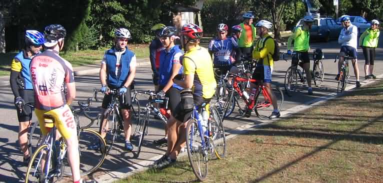
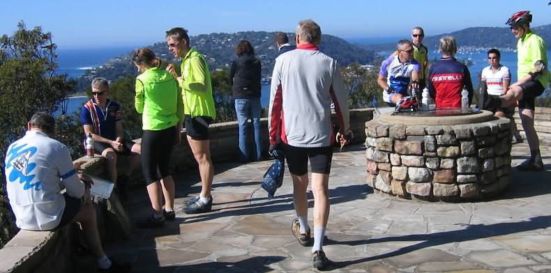
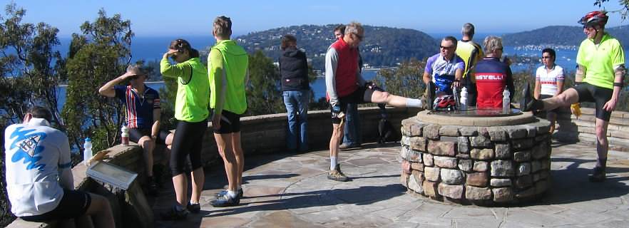
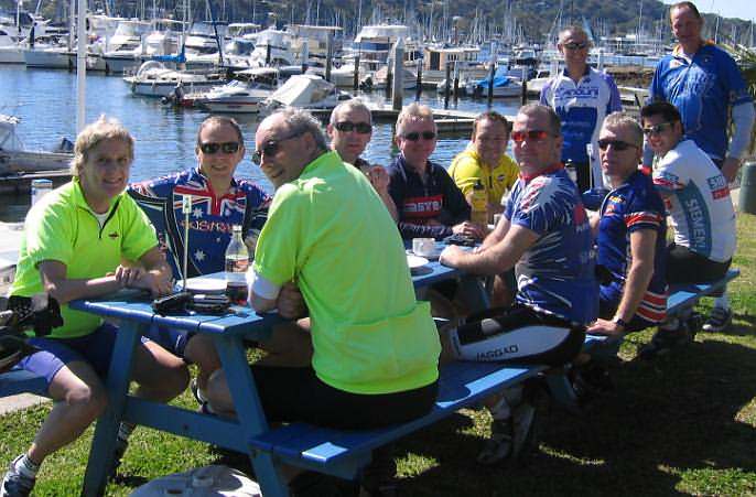
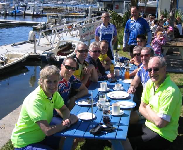
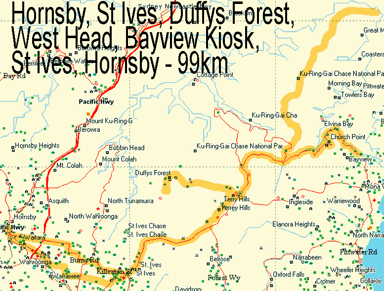
Rap-up of Duffys Forest, West Head, Bayview Kiosk, Akuna Bay - 99km - 17 crew
|
|
|
|
|
|
|
|
|
|
|
|
|
|
|
|
|
|
|
|
|
|
|
|
Scribe
26 Aug '07