Blacktown City Council - Flood Studies
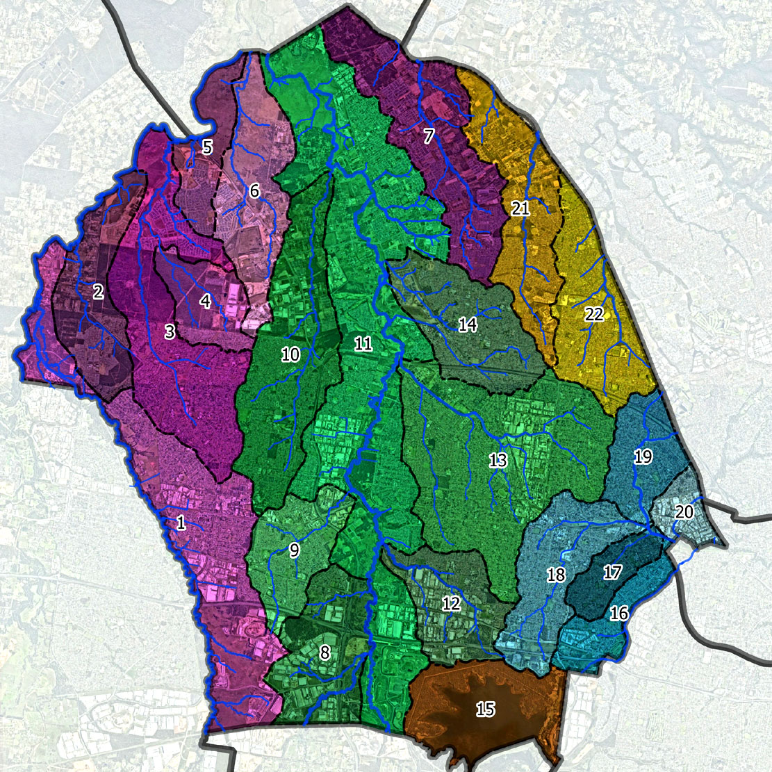
Eastern Creek is located in Western Sydney and drains a catchment area of 118 km2 to South Creek which, in turn, drains into the Hawkesbury River near Windsor. Eastern Creek drains approximately one half of the Blacktown Local Government Area.
The Eastern Creek Flood Study is now complete and was adopted by Council on 27 September 2023, after public exhibition of the study.
Flood planning controls will apply to the flood planning area below from 25 October 2023.

You can find associated flood reports here:
Eastern Creek Floodplain Risk Management Study and Plan
Council is currently seeking input from local residents and/or property owners that have experienced flooding at their property within the Eastern Creek catchment. Your local knowledge and personal experience of living in the catchment is invaluable when identifying flood ‘trouble spots’. This will ensure that the updated flood modelling reflects your experiences.
You can provide input by visiting our ‘Have your say’ website page and completing the community questionnaire.
Given the heavy rainfall our City experienced on 4 April 2024, we have extended our data collection close from 17 to 24 April 2024 in order to collect any photos/videos you may have of this event.
Catchment management

Rain that falls within Blacktown City flows into 2 major catchments (Show info), -
* either Sydney Harbour via the Parramatta River; or
* the Hawkesbury-Nepean River via South Creek.
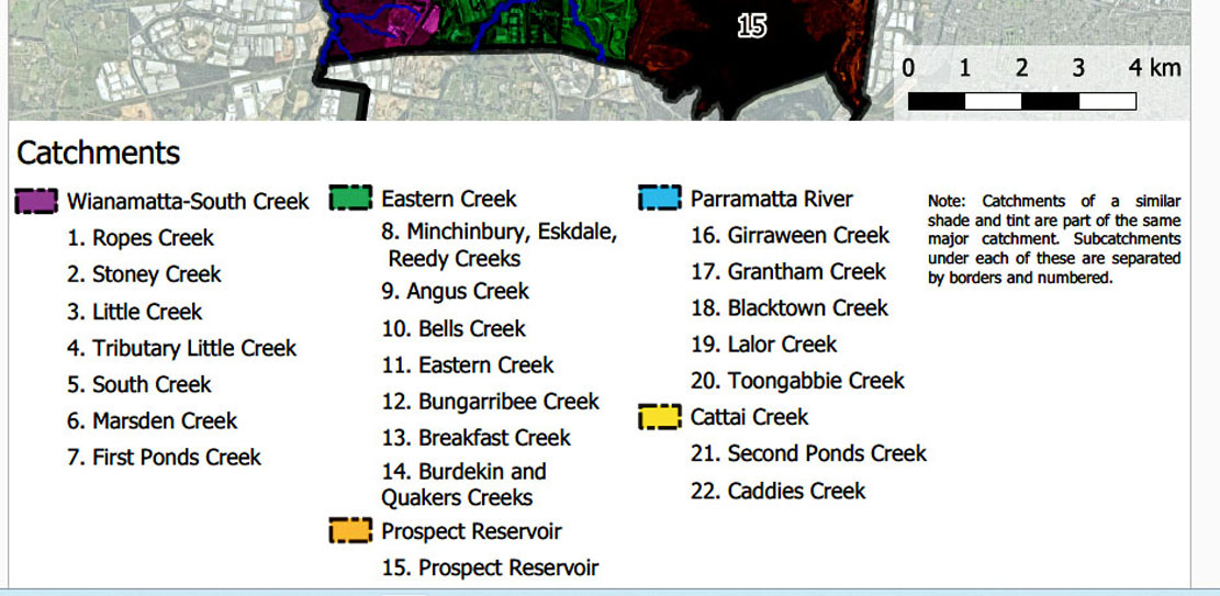
Within these 2 major catchments there are 22 sub-catchments with 262 km of defined drainage lines.
In 2015 we conducted a rapid riparian assessment (Show info) at 600 metre intervals on every creek.
A rapid riparian assessment is a process used to determine the condition of a
site, including the:
- health of vegetation (presence of weeds, vegetation structure)
- presence of erosion and sediment deposition
- presence of litter
- surrounding land use impacts.
The assessment then creates a ‘grade’ to determine overall condition of the site
ranging from excellent to severely degraded.
We are developing sub-catchment management plans for all 22 sub-catchments (PDF, 2MB) . We are doing this by:
The main outcome of the sub-catchment planning process is to define the current condition and suggest future actions to improve or protect waterway health. RE YOUR ABOVE "sub-catchment management plans for all 22 sub-catchments" WHAT ABOUT FLOOD MITIGATION? THAT IS THE BIGGEST ISSUE/CONCERN, not the above three bullet points
22 Sub Catchments