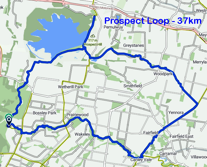
Prospect Loop Cycleway - adjacent to Prospect Reservoir - 37km - start from Guildford train station
A sealed cycleway, separated from the main road that explores Western Sydney. Follows a lot of Sydney’s historic water infrastructure, and has a range of terrain and scenery, Connects Guildford and Canley Vale on the Parramatta-Liverpool train line and takes you as far as Abbotsbury (thence visit Calmsley Hill City Farm - 31 Darling Street Abbotsbury,)
If you’re getting to the loop via public transport, start from Guildford Station and look for Prospect Canal Cycleway running adjacent to Trenton Road. Bring your own food and break up the ride by stopping off for something to eat at Prospect Dam picnic ground. It’s the ultimate trail to get your legs moving, but be sure to pack plenty of food, water and sunscreen.
Detailed in Bike riding the cycleway from the Pipehead at Guildford to the Prospect Reservoir
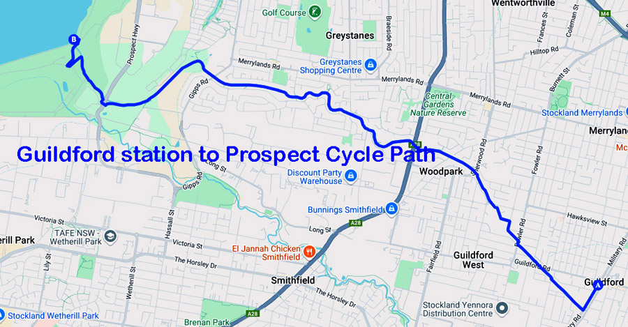
The cycleway from Guildford to the Prospect Reservoir follows the old open-air water canal that once channelled water into the Pipehead at Frank Street
Marvellous photos at Bike riding the cycleway from the Pipehead at Guildford to the Prospect Reservoir
https://web.bikemap.net/r/4758122?utm_campaign=free_actions_cta&utm_medium=route&utm_source=website
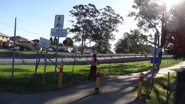
Cycleway entry at Fowler Road Guildford
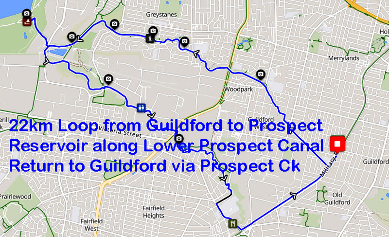
22km Guildford - Prospect Reservoir Loop · Ride with GPS
This 22km Loop ride goes from Guildford to Prospect Reservoir along the Lower Prospect Canal shared path, and returns to Guildford via the Prospect Ck shared path and a section of the Parramatta-Liverpool rail-trail shared path.
The Lower Prospect Canal has an interesting history. See en.wikipedia.org/wiki/Lower_Prospect_Canal_Reserve for details.
Bellbirds can often by heard in a couple of areas along the Lower Prospect Canal and Prospect Creek sections of the route.Start Locations:
* Arriving by train: Railway Tce side of Guildford station.
* Arriving by car: We'd suggest parking on Trenton Rd, Guildford, which is several hundred metres into the route.Finish Locations:
* Same as start locations;
* Alternative Finish Location @ Fairfield Station. At around the 19.5km mark there is an option to shorten the ride slightly and avoid the climb back up to Guildford along the rail-trail by diverting 500 metres along a shared path to Fairfield station instead. There is a note in the Cue Sheet about when to divert.