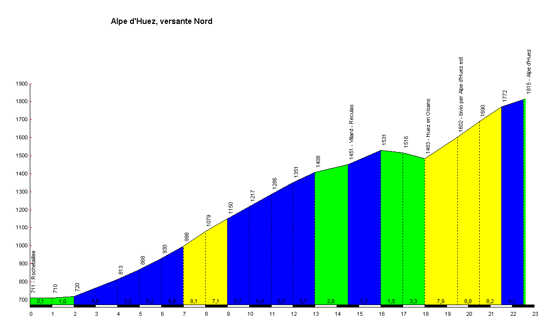
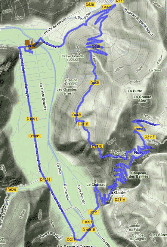
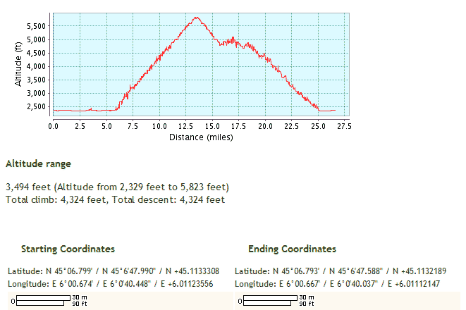
Day 11 - 22.6 km from Rochetaillée to Alpe d'Huez sommet, up Col de Sarenne - 6.9% ave - 7.4% max - more Alpe d'Huez info
*
55km
round trip (first below route map) - the reverse of last Friday's route;
or
Drive 7km NNW from our 2nd Base Camp at Bourg d'Oisan to Rochetaillée (el 430m).
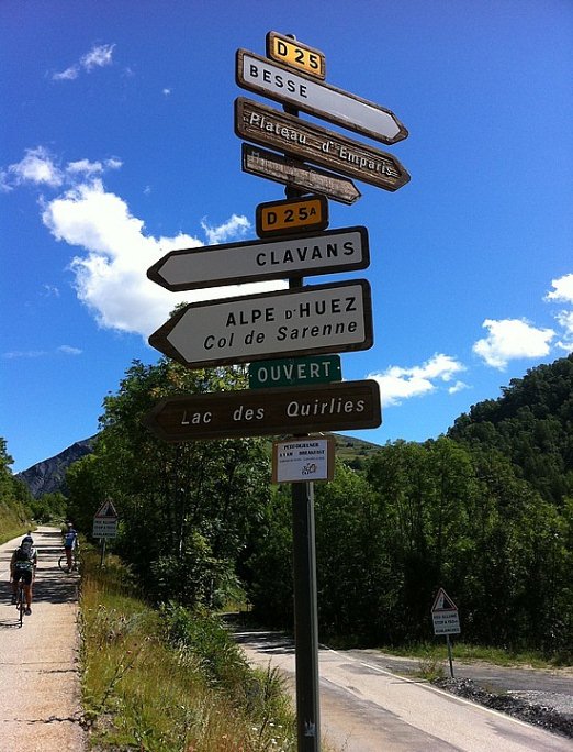
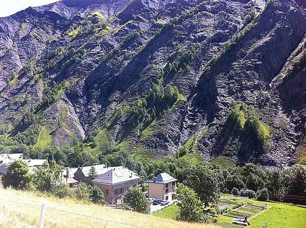
The 22.6km climb from Rochetaillée (el 430m) scaling Col de Sarenne along a quaint narrow road to Le Sommet (el 1,989m) . Descend a few km to Le Sommet of Alpe d'Huez (el 1,780m). Le Col de Sarenne is signposted in Alpe d'Huez, a small road that passes the altiport (aerodrome for small airplanes and helicopters, situated on a high mountain) as it leaves the village. The final six switchbacks are the same hairpins for the more famous ascent from Bourg d'Oisan since the two roads link together when D211B meets D211a to form D211 for the final six hairpins. After you've passed the town, Reculas (14.5km), the narrow road follows the edge of the 1,000 feet vertical drop down towards the Romanche river beyond. From Alpe d'Huez, the road quality deteriorates in places on the 200m vertical climb to the Col. A lovely descent down to the Barrage du Chambon and the foot of the climb to Deux Alpes. Continue back to the base of Alpe d'Huez at Bourg d'Oisans.

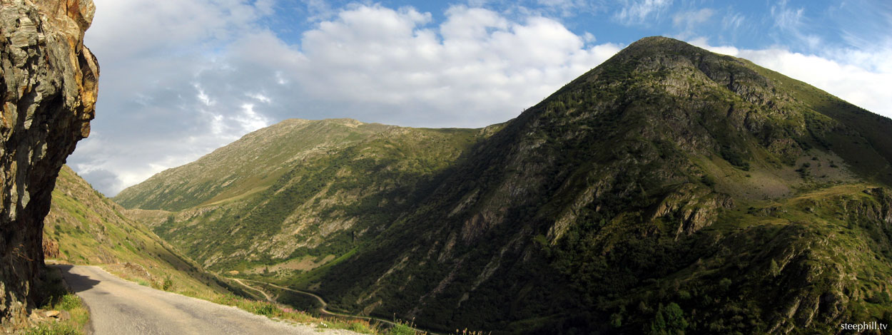
An easterly view 2km after reaching Le Sommet of Col de Sarenne
26.59 miles - 42.78 km
Definitely squiz the short movie of climbing the delightful Col de Sarenne and the magnifique panorama pics at Cycling Col de Sarenne — The B side of Alpe d'Huez provided by hill climbing extraordinaire, Casey Kasem.
Also,
http://www.grenoblecycling.com/
and
Col de Sarenne -
1372 vert. m - 24.3km
(Rochetaillée via Villard-Reculas)