Muggaccinos.com The Bullsheet
Saturday,
30 Sept '06, 7:45am
-
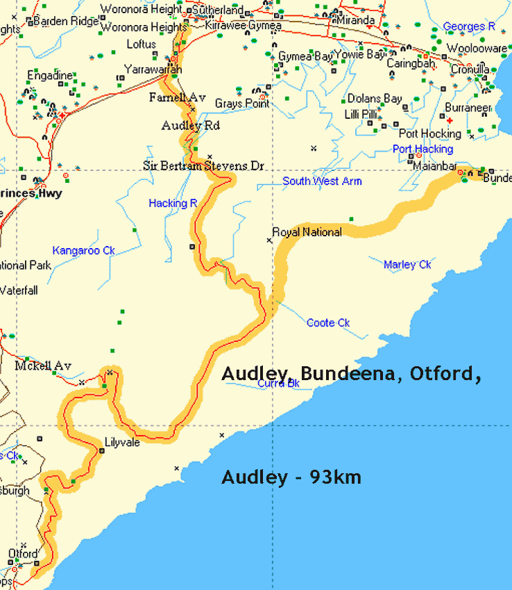
Tour de Royal National Park
via Bundeena and Otford
-
94km – ETR 2:20pm
Add 5.3km by cycling down to
Garie Beach and climbing the KOM Climb.
*
Sunrise is 5:32am.
Most of us have a 45 min drive - not exceeding the
speed limit, 'cause of double demerit points.
*
Ride Organiser:
Phil Johnston 9498.3684 hm
*
Hardcopy
these directions and bring on ride
|
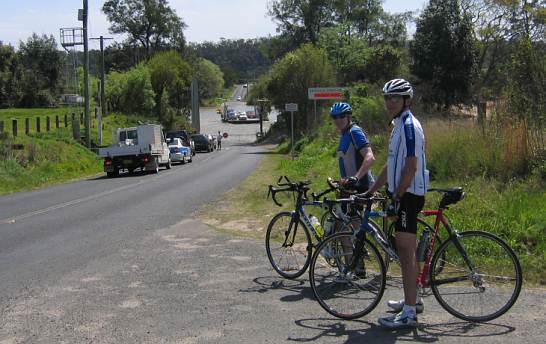
At sparrow fart on a Sunday morn' it is only 45 minutes drive [38km] from Chatswood to the Sutherland Leisure Centre, Waratah Park off Rawson Ave (approx 1km south of Sutherland shopping centre). Park in centre of open air carpark facing the swimming complex to conquer the largest national park in Sydney, The Royal National Park.
|
Driving directions from North Shore, either – Ø Homebush Bay Drive / Centenary Drive / Roberts Rd / Wiley Ave / King George's Rd / Princess H’way; or Ø Pacific Highway over Harbour Bridge onto Princess H’way at Broadway, remaining on Princess H’way crossing George’s River Bridge and passing thru Sylvania and Gymea -
|
1st Leg: Sutherland to Bundeena Beach - 26km
Rollout 7:45am. After 600m of pedaling Sth along Rawson Ave enter Princess Highway at lights and 1km later pass Loftus Oval on LHS (familiar to ‘Gong riders as the initial morning tea spot). 100m onwards L into Farnell Ave (some maps call it Sir Bertram Stevens Drive). Pass the toll booths where road changes to Audley Weir Rd and shortly descend on a dog leg R and hook L, then R to cross Audley Weir [5km]. Whereupon veer R (becomes Sir Bertram Stevens Drive) and encounter first, of several delightful treats, namely a wonderfully steep climb up Artillery Hill to Gibraltar Rock [7km] and along Flat Rock, passing Warumbul Rd on LHS [11km].
After hooking L into Bundeena Drive pause 50m along for our 1st Sag Stop (5 min) [15km]. Pedal 10.2km due E to 1st Nosh Stop (30 min) at Café Manna Bundeena in God’s Own Country, picturesque Bundeena Beach [25.5km] with spectacular views NW twds Sydney Harbour and cafés overlooking the pristine beach.
2nd Leg: Bundeena Beach to Otford Pie Shop - 31km (agg 57km)
9:25am commence 2nd climb, retracing up Bundeena Drive and halting 50m shy of Sir Bertram Stevens Drive for 2nd Sag Stop (5 min) [36.2km].
After re-grouping, hook a L into Sir Bertram Stevens Drive and high tail it along the ridge. Pass Garie Beach turn-off on LHS [41km], thence pass a bridge on RHS to McKell Ave [46km]. Road becomes Lady Wakehurst Drive which takes us to 2nd Nosh Stop (35 min) “Otford Pie Shop” [56.6km] with fabulous views of the Blue Pacific - arriving 11am.
3rd Leg: Otford Pie Shop to Audley Weir - 32km (agg 89km)
11:35am cycle Nth back up Lady Wakehurst Drive, initial 300m along the coast with spectacular views of the Blue Pacific, and then into the wooded forest where it is up-hill initially, then predominantly undulating. After 67.4km pass McKell Ave bridge (Waterfall exit) on the LHS. Cycle a further 9.5km N along Sir Bertram Stevens Drive for a further fleeting 3rd Sag Stop (3 min) at intersection of Bundeena Drive. Continue NW another 9.8km for a 3rd Nosh Stop (15 min) from 1:40pm at Audley Kiosk 50m before Audley Weir - excellent coffee 'n maggot sacks.
4th Leg: Audley Weir to Sutherland - 5km (agg 94km)
1:55pm cycle over the weir and up precipitous Farnell Ave to Princess H'way and R onto the H'way, shortly pass Loftus Oval on RHS. 2km after traffic lights at Rawson Ave turn R into Sutherland Leisure Centre - ETR 2:20pm.
CARE: Keep well to LHS along the final legs from Bundeena to Audley Weir and up to Princess H'way. If a cue of cars is behind you, pull over to side of road and allow 'em to pass.
Scribe’s rap-up of last Sunday Tour de Windsor - 13 cyclists, incl one casualty:
* from Turra' with Sackville loop - 111km
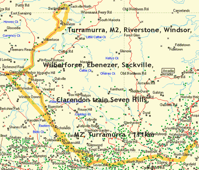
* from Porters Scenic Lookout, Dural returning via Sackville Ferry Rd, Wiseman's Ferry Rd Halcrows Rd and Cattai Ridge Rd - 95km.
|
Alas, en route along the M2, Guy aka
Lawyer, took a fall shortly after passing a parked
car, which is a rarity on a motorway (a parked car, not a spill).
Ann-Marie 'phoned for an ambulance, seeing as how Guy has max-health cover. Not too long afterwards, two shiny white ambulances arrived within a few mins of each other. One took Guy off to Hills Private. The 2nd Ambo took Guy's treadley to the same destination. Forgot to snap some pics of Guy being carted-off but recollect last time Scribe traveled in an ambulance, 'twas big enough to take is bike too. |
 |
A few hours later Guy phoned Scribe to report that he'd been x-rayed. Guy snapped his left collar bone clean in half. The doc thinks it should heal fine. Guy asked Scribe to be sure and thank all the cyclists who waited for him on the M2 this morn', as he appreciated the support.
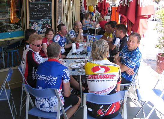
Woodies Pizza Haven in Macquarie Square Windsor after 48.5km
L to R at - Hugh, Pimpernel, Adam, Ann-Marie, Printer, Architect, The Kaiser, Greg aka Architect Too, Todd, Pacific 'n ToothFairy
John aka Auckland and Greg P. aka Architect Too at the Sackville ferry juncture after completing the Tizzana Winery loop, incl 1.6km of good dirt road. The 33km loop thru Wilberforce, Ebenezer and Sackville is normally a scenic delight with views of farm pastures and the Hawkesbury River. However, yesterday ride was the antithesis, what with us press into strong headwinds and ducking dust storms.
Ann, Pete, Hugh 'n Rex were returning via Sackville Ferry Rd/Halcrows Rd and had already headed up the hill in the rear of pic. The rest of us were about to hook a left and grab the tail wind back to Windsor.
One of the new chums, Greg P. aka Architect Too, asked where to exit the M2 as he was going to jump the early train from Windsor, because Bank Teller was cycling further West to Clarendon station.
This logical query prompted Bank Teller to create the below directions pages which will be provided in future rides using the M2:
* Enter M2 via Browns Water Hole
* Exit M2 into Browns Water Hole
* Enter M2 from Vimiera Rd, Marsfield
Scribe 24 Sept 2006