www.Muggaccinos.com The Bullsheet
Good Friday,
25 March '05, 8:45am
- Tour de Royal National Park
-
94km – ETR 3:20pm
Add 5.3km by cycling down to
Garie Beach and climbing the KOM Climb.
*
Sunrise is 7:02am. Most of us have a 45 min drive not
exceeding the speed limit, 'cause of double demerit pts.
*
Ride Organiser:
Phil Johnston 9498.3684 hm
*
Hardcopy
these directions and bring on ride
|
At sparrow fart on a Sunday morn' it is only 45 minutes drive [38km] from Chatswood to the Sutherland Leisure Centre, Waratah Park off Rawson Ave (approx 1km south of Sutherland shopping centre). Park in centre of open air carpark facing the swimming complex to conquer the largest national park in Sydney, The Royal National Park.
|
Driving directions from North Shore, either – Ø Homebush Bay Drive / Centenary Drive / Roberts Rd / Wiley Ave / King George's Rd / Princess H’way; or Ø Pacific Highway over Harbour Bridge onto Princess H’way at Broadway, remaining on Princess H’way crossing George’s River Bridge and passing thru Sylvania and Gymea -
|
1st Leg: Sutherland to Bundeena Beach - 26km
Rollout 8:45am. After 600m of pedaling Sth along Rawson Ave enter Princess Highway at lights and 1km later pass Loftus Oval on LHS (familiar to ‘Gong riders as the initial morning tea spot). 100m onwards L into Farnell Ave (some maps call it Sir Bertram Stevens Drive). Pass the toll booths where road changes to Audley Weir Rd and shortly descend on a dog leg R and hook L, then R to cross Audley Weir [5km]. Whereupon veer R (becomes Sir Bertram Stevens Drive) and encounter first, of several delightful treats, namely a wonderfully steep climb up Artillery Hill to Gibraltar Rock [7km] and along Flat Rock, passing Warumbul Rd on LHS [11km].
After hooking L into Bundeena Drive pause 50m along for our 1st Sag Stop (5 min) [15km]. Pedal 10.2km due E to 1st Nosh Stop (30 min) at God’s Own Country, picturesque Bundeena Beach [25.5km] with spectacular views NW twds Sydney Harbour and cafés overlooking the pristine beach.
2nd Leg: Bundeena Beach to Otford Pie Shop - 31km (agg 57km)
10:25am commence 2nd climb, retracing up Bundeena Drive and halting 50m shy of Sir Bertram Stevens Drive for 2nd Sag Stop (5 min) [36.2km].
After re-grouping, hook a L into Sir Bertram Stevens Drive and high tail it along the ridge. Pass Garie Beach turn-off on LHS [41km], thence pass a bridge on RHS to McKell Ave [46km]. Road becomes Lady Wakehurst Drive which takes us to 2nd Nosh Stop (35 min) “Otford Apple Pie Shop” [56.6km] with fabulous views of the Blue Pacific - arriving 12pm.
3rd Leg: Otford Pie Shop to Audley Weir - 32km (agg 89km)
12:35pm cycle Nth back up Lady Wakehurst Drive, initial 300m along the coast with spectacular views of the Blue Pacific, and then into the wooded forest where it is up-hill initially, then predominantly undulating. After 67.4km pass McKell Ave bridge (Waterfall exit) on the LHS. Cycle a further 9.5km N along Sir Bertram Stevens Drive for a further fleeting 3rd Sag Stop (3 min) at intersection of Bundeena Drive. Continue NW another 9.8km for a 3rd Nosh Stop (20 min) at Audley Kiosk 50m before Audley Weir - excellent coffee 'n maggot sacks.
4th Leg: Audley Weir to Sutherland - 5km (agg 94km)
1:30pm cycle over the weir and up precipitous Farnell Ave to Princess H'way and R onto the H'way, shortly pass Loftus Oval on RHS. 2km after traffic lights at Rawson Ave turn R into Sutherland Leisure Centre.
CARE: Keep well to LHS along the final legs from Bundeena to Audley Weir and up to Princess H'way. If a cue of cars is behind you, pull over to side of road and allow 'em to pass.
Scribe’s rap-up of Sunday 20 March 05, Tour de Central Coast - 123km - 9 starters
Arrival at Mt White evidenced Engineer, Yamaha, Tornado, LongHaul, Scribe, Printer, Heineken, Koala Bear and Publican shooting the breeze on a coolish o'cast morn'. We saw heap plenty Coppers, 'cause there was a motza of motor bikers, some passing us way to close and way to fast. The bikers were headed for a Motor Bike Show Day at Sydney Reptile Park (nee Old Sydney Town). And the Bobbys were intent on ensuring they didn't speed excessively.
Our advertised Pearl Beach route got jettisoned when Yamaha and Printer wanted to visit a bike shop at Erina to suss-out a FSA 110mm BCC double front chain ring. The rest of us didn't have anything pressing, so we opted for a longish coastal scenic route which included climbing a killer 1km Wards Hill Rd to Killcare Heights. LongHaul sent data output from his Polar gismo:
* Peak gradient for Ward's Hill Rd entrance is 14.9% measured over 100m starting 440m from the turnoff to the servo (not the main road).
* Bottom section is 14% going into the 1st corner. (almost as steep as Kissing Point Rd but well off Loombah St and Old Bathurst Rd).
* Climb length is 958m with a vertical climb of 105m giving an average grade of 10.96%.
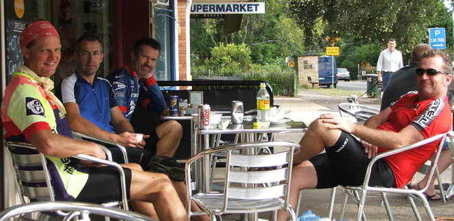
Post-ride outside the Corner Cafe, Nth Turra'
The Scribe 20 March 2005