www.Muggaccinos.com The Bullsheet
Sunday, 5 Jan, 6:45am from St Ives for "Brunch at Warriewood" - return via Wakehurst Parkway - 95km - ETR 12:10pm
Ride contact: Phil Johnston 9498.3684 hm
Hardcopy these directions and bring on Sunday
-
Cycle 2 abreast on single lane roads at own peril
-
Get well off the road at Sag Stops
-
Membership of Bicycle NSW provides $20m Public Liability cover if you injure a fellow Mugg or motorist
Snapshot :
Rollout St Ives 6:45am Terrey Hills, Duffy’s Forest, West Head (1st Nosh Stop) – pack nibbles), Church Point, Warriewood (2nd Nosh Stop). Return Wakehurst Parkway and Forest Way - ETR St Ives 12:10pm.
1st
Leg: St Ives to
West Head, via Duffys Forest - 41.2km - 113 min
Depart St Ives car-park by 6:45am
-
E along Mona Vale Rd for 6.2km;
-
L [opposite Forest Way - at Mona Vale Fruit Barn] into Myoora Rd and take a fleeting Sag Stop (3 min);
-
3km along Myoor Larool Rd until 70m before Booralie Rd;
-
L into Tepko Rd (75m short of Booralie Rd) for 400m;
-
L into Booralie Rd and pedal like "shit out of Shanghai" 6.7km flat/fast stretch past Terrey Hills Golf Course and rifle range to Duffys Forest (amidst real pigs, goats, horses 'n cows);
-
"U" turn at the dead-end of Cow Corner – slower cyclists must turn around as soon as they see lead cyclists returning to return via same route and pull up under shady tree [left of the white road line] 150m past Terrey Hills neighbourhood shopping centre [opposite Terrey Hills Thai Restaurant] for a Sag Stop [3 min];
-
Down McCarrs Creek Rd enter Ku’ring’gai Chase National Park for 3km to "V" (dual entrances to the park);
R at the "V" anti-clockwise and descend to McCarrs Creek;
L over bridge for 1.8km to "T" juncture (Akuna Bay Marina is 2.8km on LHS);
Ahead 12km along West Head Rd to the headland.
Pack lots of nibbles, ‘cause we take our 1st Nosh Stop (15 min) from 8:35am for a snack and a gawk at the majestic, shimmering blue peninsula - Pittwater/Lion Island stuff.
2nd
Leg: West
Head to Warriewood - 28.8km - 71 min
8:50am
-
-
Return 12km to "T" juncture with Akuna Bay,
-
Ahead descending 1.8km to McCarrs Creek bridge at 9:25am [55km],
-
L into McCarrs Creek Rd for 8.8km past Church Point, Bayview Marina and pulling up 50m before Cabbage Tree Rd (or immediately after turning ,
R into Cabbage Tree Rd for Sag Stop - lift bike off the road above gutter [5 min] ( (Bayview Golf Course will be on both L and R);
Ahead for 1.5km leads into Samuel St and crosses Mona Vale Rd at roundabout,
-
R into Warriewood Rd 200m later crossing Pittwater Rd at traffic lights and immediately climbing up Hunter St [dog-leg L, then R] which leads to views of Blue Pacific overlooking majestic Warriewood Beach [around 10:15am - 71 km] for 2nd Nosh Stop (35 min).
A neighbourhood, strip-front shopping centre is immediately on RHS in Narrabeen Park Pde. Nautilus Café is about 4 shops along. Sunrise Milk Bar, on the cnr, makes grouse burgers.
3r
d Leg: Warriewood beach cafés to St Ives, via Wakehurst Parkway - 26.5km - 84 min
10:50am -
|
| Sth adjacent to the coast for 2km - initially along Sydney Rd which becomes Ocean St; |
|
| R into Malcolm St for 50m; |
|
| L into Lagoon St for 1km; |
|
| R into Waterloo St for 300m; |
|
|
R into Pittwater Rd for 100m crossing bridge over Narrabeen Lakes; |
|
|
veer L into Wakehurst Parkway for a toughish 9.9km (initially flat past Narrabeen Lakes thence a constant climb) for Sag Stop either approaching crest of climb immediately prior to traffic lights at French Forest Rd or at the lights, so long as you get off the road; |
|
|
R into French Forest Rd at lights for 800m; |
|
|
R into Rabbett St for 200m decent; |
|
|
L into Adams St for a 200m "real tough" grind/climb; |
|
| R onto Forest Way for 5.3km; and |
|
| L into Mona Vale for 6.2km to St Ives. |
ETR 12:10pm - 95km.
Bank Teller's rap-up of New Year's Day, Wed, 1 Jan, Royal National Park - 94km
Our sojourn south to the RNP only attracted 4 starters on an o'cast morn' where we only saw one solitary pack of cyclists during our 94km reconnoiter with lots of hills, especially the 2km climb up Gibraltar after crossing Audley Weir.
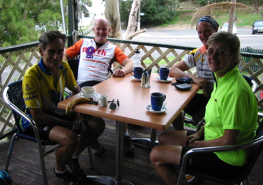
Whippet, Navigator, Teller 'n ToothFairy at The Red Gecko cafe overlooking Bundeena Bay and the Harbour.
| After 56.5km we pulled in at the Otford Apple Pie Shop 4294.1243ph where, during previous rides, the view
down the south coast, has been spectacular. Today it was a murky,
pea-soup. But it didn't deter our appetite, where burgers took a
beating.
At 1:20pm we arrived back at Sutherland Leisure Centre whereupon the skies finally began to open. |
 |
The Scribe 1 Jan 2003