Looking back from Valloire
http://www.steephill.tv/2006/alpe-d-huez/
http://www.podiumcafe.com/2008/7/22/576404/the-godzilla-stage-explori
|
|
Looking back from Valloire
http://www.steephill.tv/2006/alpe-d-huez/ http://www.podiumcafe.com/2008/7/22/576404/the-godzilla-stage-explori |
|
|
|
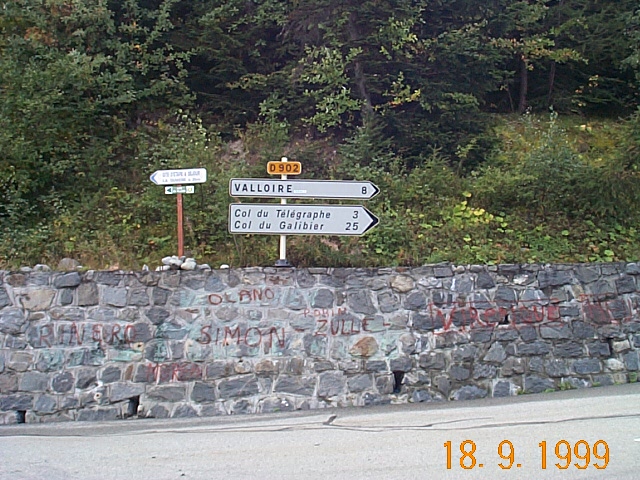
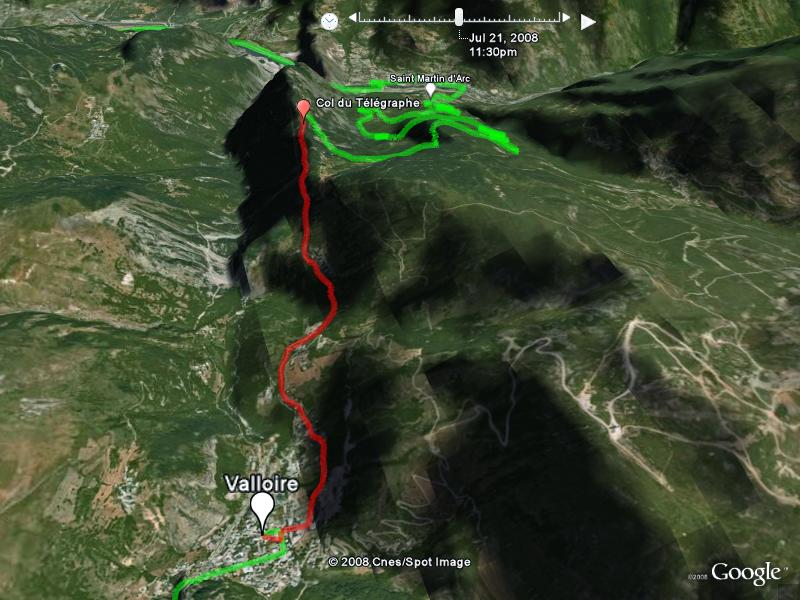
Day 3 - Le Châtelard (Northern ascent) of Col du Galibier up 'n back to St-Michel-de-Maurienne - 69.6km - more Col du Galibier info
Drive 14.1km D1006 from our Base Camp at Saint-Jean-de-Maurienne to the township of St-Michel-de-Maurienne (el. 712m).
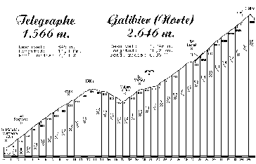
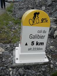
Climb 34.8km to Col du Galibier (el. 2,642m), via Col du Telegraphe (el. 1,566m) and Valloire, with 2,100 vertical meters comprising an ascent of -
1st 12.6km from St-Michel-de-Maurienne to Col du Telegraphe (el. 1,566m) with lots of shade, then 5km descent to township of Valloire - 6.75% ave - 9% max
2nd 18.5km from Valloire to Col du Galibier (el. 2,642m) - 6.9% ave - 10% max, where it gets nasty after the valley into Plan Lachat.
The Col du Telegraph is so named because at the very top of the climb is a series of radio and TV towers. It's a rather large cement structure that can be seen for a long way. So as you begin the climb, you can see your goal (the towers) way up the mountain.