|
| |
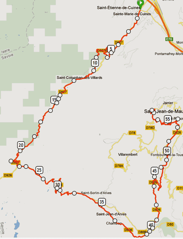
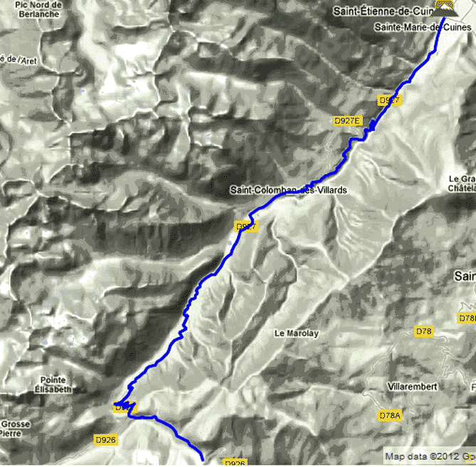
Day 4 -
Croix de Fer from
St-Etienne-de-Cuines via Col du Glandon descend Chambon &
FontCouverte-la-Toussuire - 57.8km
Drive 29km NW from
our 1st Base Camp at
Jean de Maurienne
(el. 560m)
on A43 to our Start at St-Etienne-de-Cuines (el.
494m).
Climb
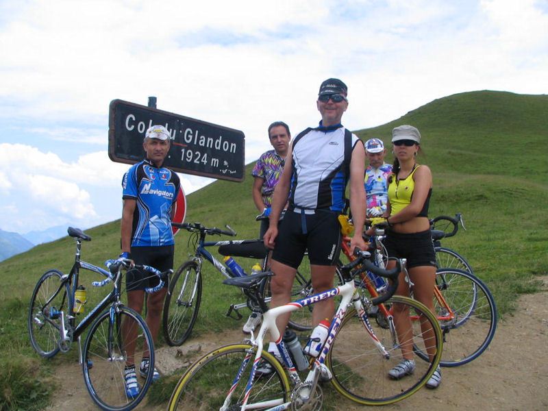
18.5km to Col du
Glandon (el. 1,924 m) and a
further 2.5km to Col de la Croix de Fer (21km
- el. 2,067 m) ascending 1,507 vert. meters,
ave 7.1% - max 8.5%. A scenic, challenging climb, which due to its proximity to
other epic climbs, and the absence a nearby town, the Croix de Fer will never be a stage finish in Le Tour.
It has been given
Hors Categorie
status.
Descend 1,507m
via Chambon (37km), with a vicious
21.8% short sharp ascent just before
FontCouverte-la-Toussuire (45km), back to our Base
Camp at
Jean de Maurienne
(el. 560m - 57.8km).
Road route
directions - 57.8km
|

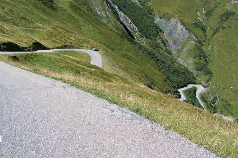
The road to the summit,
2006 |

A lonely climb… |
|
An
option for amateur riders is to ride the Col from
Bourg d’Oisans at the foot of l’Alpe d’Huez to Le
Grand-Bornard.
This approach is definitely the scenic route, but it
is far from gentle. Official statistics say that the
northern slopes are the more difficult, with 30kms
of climbing at an average of 5.1%, pitching over
6-7% for the last 7km. The scenic route from the
south is, in comparison, around 27km at 4.7% on
average. There are, however, plenty of sections
close to 10% and even a kilometre of 12% to
negotiate halfway through the climb. |
|

Several ways to the
top(s) |

Le Summit |
|
The run up the valley from Bourg d’Oisans offers the
chance to warm up the legs, as well as to grab
supplies from Allemont where the local
boulangerie/patisserie offers an excellent
selection. As the gradient starts to climb, views
over the Lac de Verney reservoir can be had before
the road disappears into the tree line. It is
long, steady climbing where a good rhythm will
suffice. There are short hairpin descents after the
village of le Rivier de Allemont, which pitches up
at 12% (there are warning signs!) on the other side
for around a kilometre. There are also some steeper
sections close to the Lac de Grand Maison, which is
a nice place to admire the spectacular alpine
scenery now that the road has left the forest behind
and is winding up the craggy pasture mountainsides.
With 1km to go, there’s the turn off to the left for
the Col du Glandon, whereupon the looming summit of
the Croix de Fer beckons. |
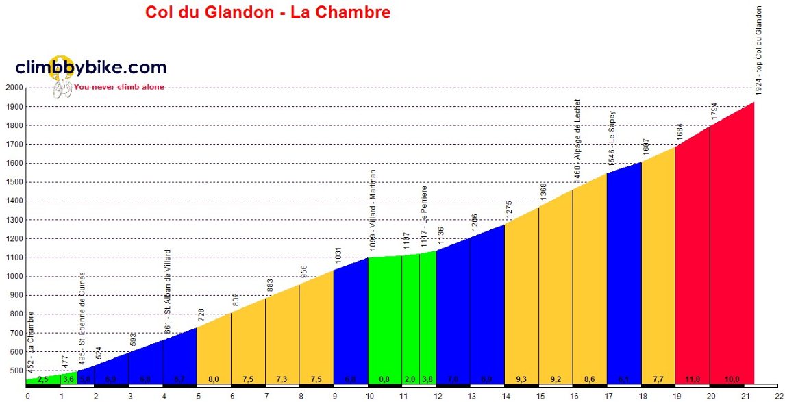
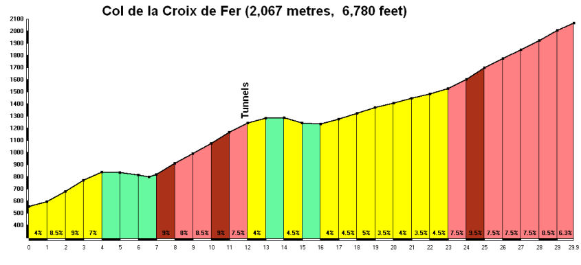
Elevation Profile from La
Chambre (3km from St-Etienne-de-Cuines) to Col
du Glandon
21.5km
route from La Chambre (3km from
St-Etienne-de-Cuines) to Col du Glandon
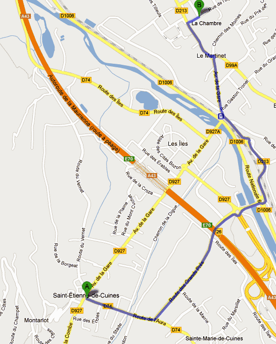
3km from La Chambre to
St-Etienne-de-Cuines
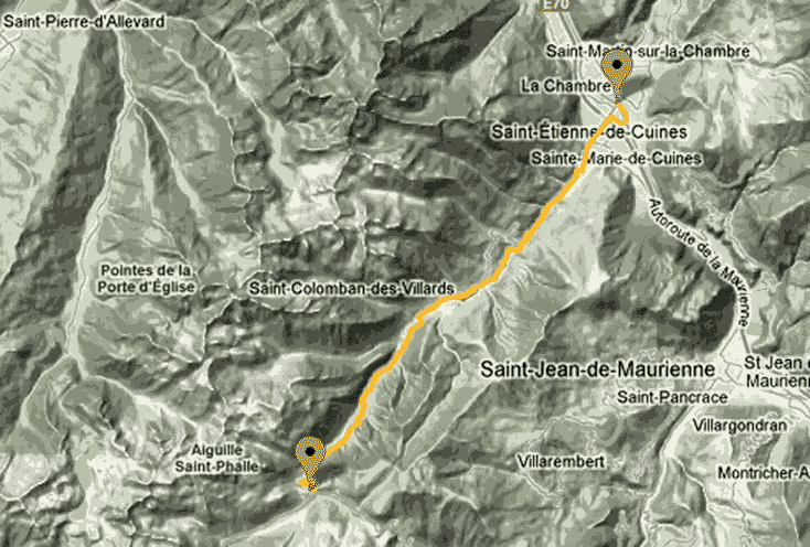
29.9km route from
St-Etienne-de-Cuines to Col du Glandon
http://le-grimpeur.net/blog/archives/12
| |
|